We have created a small atlas for each parish in the Chew Valley as an experiment to help guide a process of engagement in woodland creation. The six maps of each parish act as a guide to understanding and a basis for discussion. You can find the maps on the My Parish page.
Coordinating woodland creation, whether it is woodland, agroforestry, hedges or individual trees requires a conversation with and between landowners. To have that conversation you need to know who the landowners are and what to say to them. Knowing where suitable marginal land for tree planting is means that you can look for that specific land owner rather than all landowners. Some parishes may have little or no marginal land suitable for ‘woodland’ creation but they may opportunities for agroforestry either as part of an arable system or on pasture. Before setting off on a parish woodland creation journey it would be useful to know what to say and to who. The following example uses extracts from the maps for Winford parish. The complete map legends can be found on the maps themselves. The opportunity woodland is depicted in a dark red to contrast with existing woodland in green. It is blocky because it is based on a 50m grid.
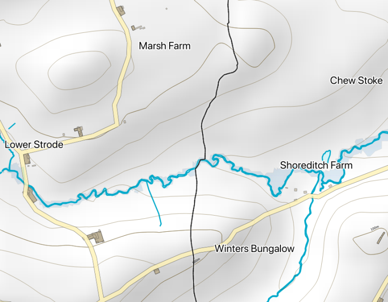
Get the Lie of the Land
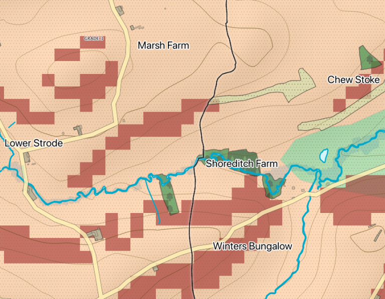
First get the lie of the land to appreciate its form and the way that water moves through it. This first map shows lightly shaded relief, contours, buildings, roads, brooks and open water. A light blue wash also shows those areas that are in flood alert zones.
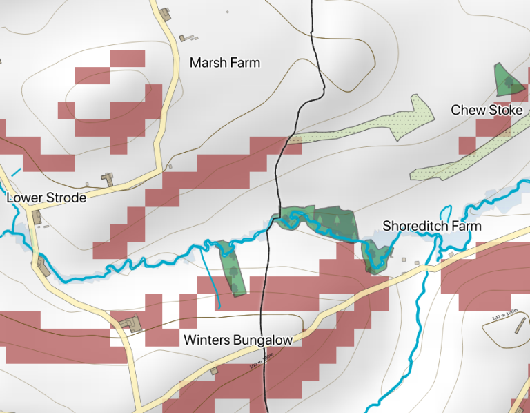
Where are existing and potential woodland
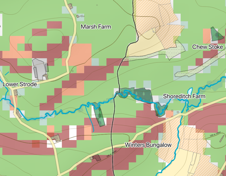
This map shows existing woodland in shades of green and areas of opportunity woodland in red. Opportunity woodland that is next to existing woodland may be suitable for natural regeneration, making using of the existing woodland as a seed source.
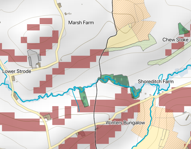
What about avoiding protected areas and important habitats?
We don’t want to replace valuable habitats or protected areas with woodland. The map below adds protected areas and priority habitats including two areas of ‘good quality semi-improved grassland’ (tufts), and lowland meadows in yellow and a cross-hatch area of ‘no main habitat’. The red opportunity woodland deliberately avoids these potentially important habitat areas which may be biodiverse grasslands. Before converting grassland into a wood make sure you are not displacing an important patch of grassland biodiversity.
Finding the right person to talk to
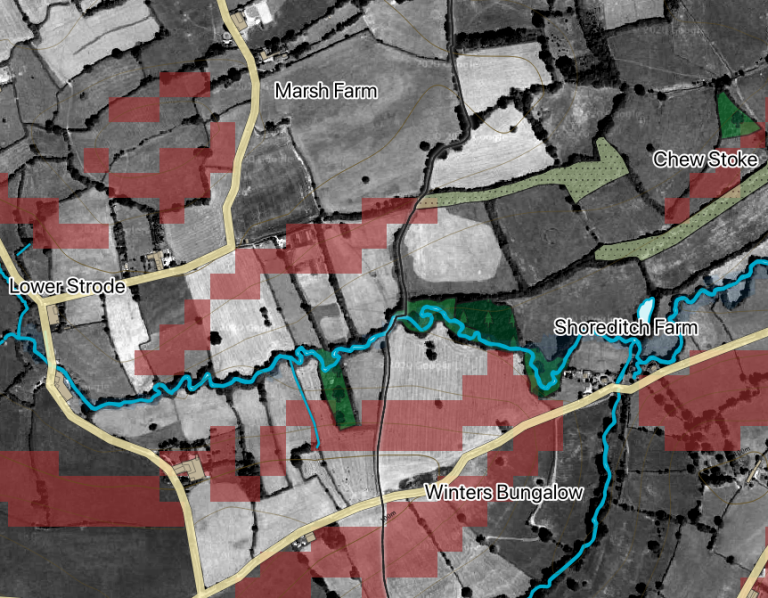
Having satisfied yourself that a patch of land has potential for woodland creation, for example the central linear patch north of the brook, you might want to talk to the land owner and their neighbours and encourage them to consider the proposition. But who are they? The easiest way to find who owns a piece of land is to ask local farmers or somebody on the parish council, you can probably find somebody who knows. Failing that you might need to referent to the Land Registry but sometimes land has not yet been registered. Have a look at the Finding Land Owners page for more information.
What Grade is the land?
Having found a patch of land for consideration you can think about starting a conversation about woodland creation with the land owner(s). Before starting the conversation it is best to know what the quality of the land is like by checking on the Grade of the land according to the Agricultural Land Classification. In this map it can be seen that the land is mainly the buff colour or Grade 3, good quality land. The steep bits are Grade 3b or moderate quality and more suitable for woodland creation. Grade 3 land tends to be pasture although this is not always the case.
How much arable and pasture is there for agroforestry?
On this map the pasture is shown in green and the arable in orange. This is a general indicator and is generally correct. Arable land tends to stay arable land but may have temporary grass cover as part of its rotation.
Have a look at the full Parish Maps and the Finding Land Owners pages for more information on existing and potential woodland resources and how to track down land owners.
Summary Parish Statistics
Each of the parish maps includes a panel of summary statistics including the areas and percentages of existing and opportunity woodland, arable and grasslands. These statistics are helpful to gauge whether a parish is woodland deficient, whether it has the potential to double woodland cover and where agroforestry is an option.
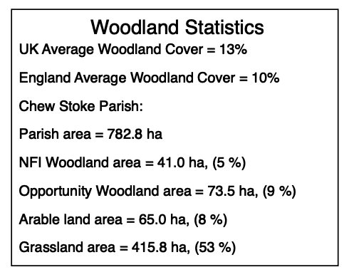
Chew Stoke has woodland cover of just 5% or half of the England’s average. There is potential to create an additional 9% which would bring it up to 14%, above the UK’s current figure. The parish has a lot of pasture land which means that there is potential for silvopasture but this should avoid the protected areas and priority habitats that may contain biodiverse grasslands of which Chew Stoke is well endowed.