What is the difference between woodland and tree canopy cover in the Chew Valley?
Woodland
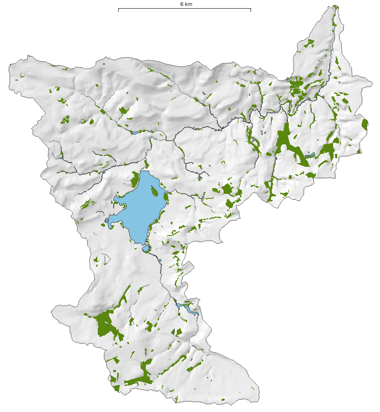
Woodland and Tree Canopy are two related but different things and that difference is important. Woodland is defined as areas that are greater than 0.5 hectares in size, with a minimum or average width of 20m and potential canopy cover of 20%. It is important to have a standard definition so that comparisons can be made between different areas both within England, between devolved administrations, internationally and between time periods. But this excludes small woods (< 0.5 ha) and individual trees. The Forestry Commission undertakes periodic National Forest Inventories, so they do all the hard work of woodland mapping. Below is their woodland map of the Chew Valley for the year 2020. The Chew Valley has an area of 14,344 hectares (ha). The woodland area, excluding internal grassland, for 2020 is 937 ha, so that is 6.53%. That is almost exactly half the national UK average. It is not quite as bad as that because of the lake, but it is still bad. It is also very unevenly distributed.
Tree Canopy Cover
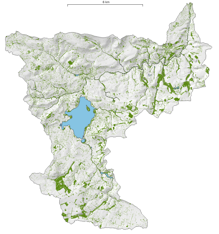
Tree canopy is the area covered by all trees, either clumped together in woodland patches of more than 0.5 ha, clumps smaller than 0.5 ha, or even individual trees standing on their own. This is rather different to the definition of woodland above which might include areas with canopy cover of as little as 20% in areas more than 0.5 ha in size. The map below is the tree canopy cover map that Terra Sulis made for Friends of the Earth using Environment Agency LiDAR data. The area of the Chew Valley hasn’t changed at 14,344 ha, but the area of tree canopy is 1,826 ha, almost twice as much as the woodland value at 12.7 %. So counting all of the trees, within woodland (> 0.5 ha), within small-woods (< 0.5 ha), and individual trees we get a very different area. This is because the Chew Valley is quite rich in small patches of trees and hedgerow trees, but don’t be fooled into thinking this is good, it is still low.
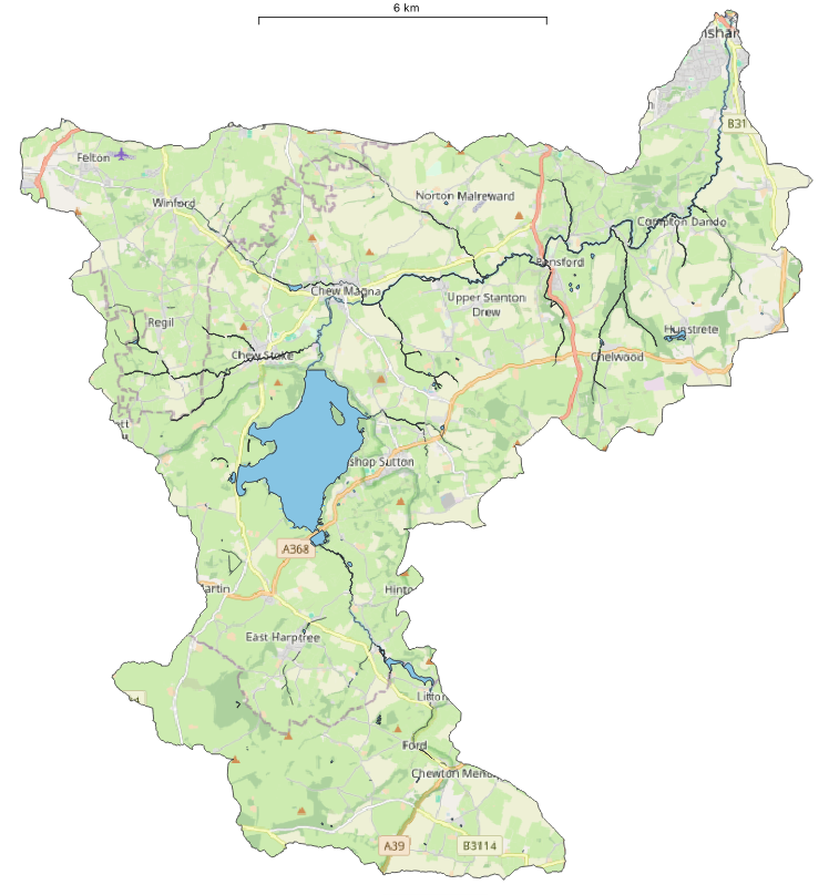
The Chew Valley is a natural landscape unit. All of the runoff in the valley drains to the River Avon in the top right hand corner – except for the water extracted from the lake for Bristol’s water supply.
Here is a Chew Valley OpenStreetMap for reference.