Light Detection and Ranging (LiDAR) is a commonly used technology for creating digital terrain and surface models. An air bourn laser is used to measure the distance from the aerial platform to the surface. Such models are useful for a broad range of applications including flood mapping, solar illumination calculation and archaeological site identification. The release of the Environment Agency’s LiDAR imagery under the Open Government Licence now makes these data generally available. The imagery provides accurate height information at a high spatial resolution and can be processed in a variety of ways to extract valuable spatial information.
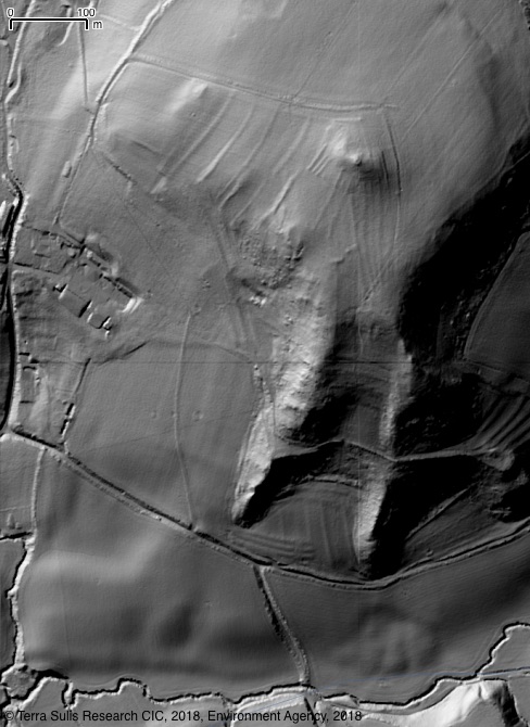
The following example shows spoil from a mine working hidden beneath a tree canopy.
Aerial view and a shaded relief maps & seeing through tree canopy:
 |
 |
| Google Imagery | EA LiDAR, shaded relief |
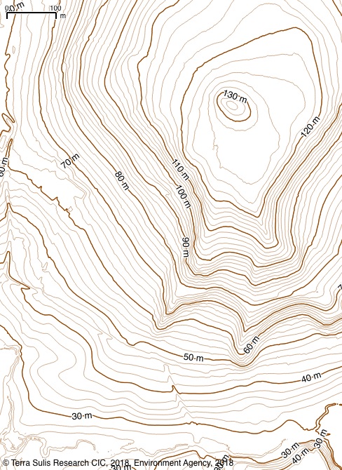
Calculation of detailed contours from the LiDAR, combined with colour coded shaded relief:
 |
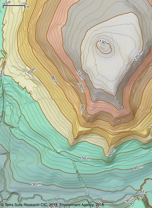 |
| Derived 2 m and 10 m contours | Colour coded shaded relief with contours |
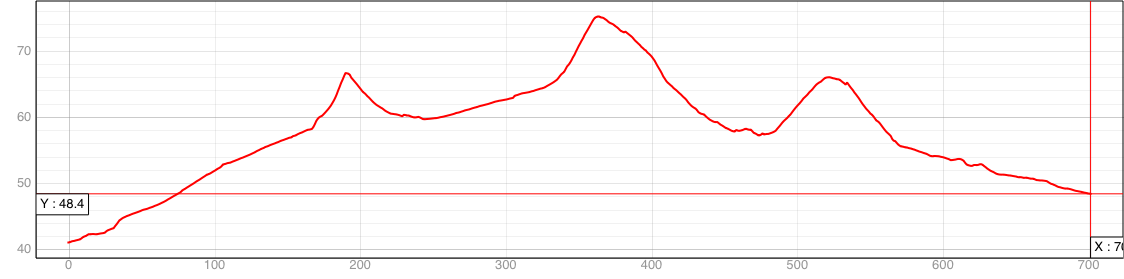
Terrain profiling across the mine tailings above:
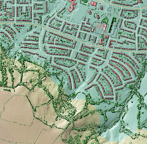
The LiDAR data can also be classified into terrain, buildings and vegetation:
 |
Email info@terrasulis.org if you have LiDAR data processing and analysis requirements. |
This page contains public sector information licensed under the Open Government Licence v3.0
This page also contains an image derived from Google 2018.